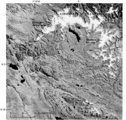
Cordillera de Vilcanota
The Cordillera de Vilcanota has the second largest concentration of glaciers in Peru; it extends in a northerly direction for about 80 km and then in a westerly direction for about 40 km between lat 13°39' and 14°29'S. and long 70°31' and 71°20'W. The glacierized area is 539 km², as estimated from Landsat images. Drainage is eastward to the Atlantic Ocean by Río Vilcanota, Río Paucartambo, Río Inambari, and Río Madre de Dios. The highest mountain is Nevado Auzangate at 6,384 m asl. Hollin and Schilling (1981, p. 191), referring to the work of Mercer and Palacios (1977), note that "on the north side of [Nevado] Auzangate (6,400 m) in the Upismayo Valley, the present glacier front is at about 4,600 m, while the late Wisconsin-Weichselian limit (sometime between 29,000 and 14,000 B.P.) was at about 4,200 m and the lowest Pleistocene limit at 3,650 m."
The Quelccaya ice cap (Zamora and Ames, 1977) is the largest single glacier in Peru. As previously mentioned, the Ohio State University's Institute of Polar Studies, in cooperation with the Government of Peru, carried out extensive paleoclimatic investigations from 1974 to 1984 of this low-latitude ice cap. In 1983, the project drilled two ice cores measuring 164 m and 154 m in length that contained a climatic record for the past 1,500 years. The next figure is a Landsat image of the Cordillera de Vilcanota area.


